We were looking for a quick and easy getaway at the beginning of the summer, and found Belize. Belize is nestled between Mexico and Guatemala on the southern end of the Yucatan Peninsula. It's just a couple of short flights from Wichita (here to Houston, then direct to Belize City), they speak English, and they take American dollars. Couldn't be much simpler.

We decided we'd like to spend time both inland and on the coast so we could see some of the Mayan ruins, the caves, and the inland wildlife along with the famous barrier reef and islands. A list of activities came together pretty quickly, and we decided to start with 5 nights inland in the Cayo District and end with 4 nights on the beach in San Pedro on Ambergris Caye.
Here's a map of the Mountain Pine Ridge area:

We compared a few of the lodges in the area and settled on Hidden Valley Inn and Reserve. It's a small inn set on several thousand acres of private reserve loaded with wildlife, miles of trails for hiking, and several waterfalls. They have expert guides on-site to take you on tours of the property, and out to the surrounding attractions, and they got great reviews on TripAdvisor. Another bonus was the fact that they have their own private airstrip on the property, meaning we could skip about three hours of driving on rough roads and just fly right in. You can see the location of Hidden Valley Inn on the map above. (Hint: It's close to Thousand Foot Falls on the right side of the map.)
June 3: Getting There
We arrived at the international airport outside Belize City in the late afternoon. Immigration was a breeze compared to the one other Caribbean country we've visited - we were through in about five minutes. (Tip: pick the line closest to the local citizens' line, because when that line is empty, your line gets to feed to two stations instead of just one.) We collected our bags, and walked out of the main terminal where we were met by our pilot from Javier's Flying Service, Alisa, for our flight from Belize City to Hidden Valley Inn's airstrip. She handed our checked bags off to get rescanned, ushered us through security, and led us out to the Cessna 172 for our flight to the inn. We got settled into the airplane (Jeff took right seat and I took the back seat), and off we went, no waiting.

We were in the air for about 30 minutes, and Alisa pointed out some interesting features on the ground during the flight. She was great at answering our questions about the country and the landscape on our way in. The ground was pretty swampy looking near the coast, but gradually transitioned to hilly jungle.

We flew over this farm and learned that those were orange trees. We came back down that road a few days later on one of our tours.

Alisa had no trouble finding the airstrip and put us back down on the ground safely.


One of the guides from the hotel, Freddy, picked us up in the van and drove us to the inn where the desk staff checked us in, gave us refreshing lemongrass tea, and showed us our cottage. It was pretty nice for roughing it in the forest.


We had dinner at the lodge, and then called it a night. We did have our first wildlife sighting on the walk back to our cottage. A small mammal ran past us in the dark. We decided it must have been the local house cat. A few days later we learned that there was no local house cat, and that we probably saw a margay or a gray fox.
June 4: Rio Frio Cave, Caracol Mayan Site, Rio On Pools
On on first full day in Belize, we woke early to the sounds of the birds outside our room (4:48 am, to be precise). We slept in a little, and then made it over to the lodge for breakfast at 7 am. Freddy stopped by the dining room to let us and a few others know that he'd be taking us out on our tour for the day, and that we should be ready to go at 8. We met up with another couple and a family in the lobby and off we went.
Our agenda for the day included a stop at a cave, a visit to a major Mayan ruin site, and a swim in the river. We headed south from the hotel, and about an hour later, made it to the cave.
This is Rio Frio cave. It's limestone, and was formed primarily by water erosion. This particular cave was only a couple thousand feet long, and had wide openings on both ends, so it was lit well enough inside to see the formations without a flashlight.
This is at the entrance looking in:

As you walk in, you can see some stalagtites.

The river had made some interesting patterns with the rock.

We thought the vines hanging down in the entrance were pretty cool.


We hopped back in the van and traveled a few more minutes, passing through an old British military encampment, which was now partly in disrepair and partly occupied by the Belizean military. A few years ago they started having problems with Guatemalan bandits coming into this area to rob tourists and steal from the Mayan ruins, so now they have a permanent station where we had to check in before we were able to drive any farther south.
We had to drive another 45 minutes or so to get to the Mayan ruin. We crossed the river on the way.

We finally made it to our primary destination for the day, Caracol, the largest Maya archeological site in Belize, at about 11 am. Here's an excerpt from Caracol.org describing the site:
Caracol is the largest Maya archaeological site in Belize, Central
America. In AD 650, the urban area of Caracol had a radius of
approximately 10 kilometers around the site's epicenter. It covered an
area much larger than present day Belize City (the largest metropolitan
area in the country of Belize) and supported more than twice the modern
city's population. Urban Caracol maintained a population of over
140,000 people through the creation of an immense agricultural field
system and through elaborate city planning. Caracol is noted not only
for its size during the Maya Classic era (A.D. 250-950), but also for
its prowess in war; this includes an AD 562 defeat of Tikal (Guatemala)
and a subsequent conquest of Naranjo (Guatemala) in AD 631.
Caracol was rediscovered in 1937, but it wasn't until the 1950s that they really started to explore the site. In the 1980s, a couple from the University of Florida began to excavate it, and they have been in charge of the archaelogical work ever since.
Here's a map showing the buildings they've uncovered so far:

We started our tour in the upper right corner of the map, in the B60s. These were residential buildings for the elite.


We saw our first howler monkey of the day in this area. We saw another five at the end of the tour in an area nearby.

We walked through a mostly unexcavated area next (the B20s, for those keeping track on the map). It was interesting to see how the trees and other jungle plants can easily disguise the structures underneath. You can also see how difficult it might be to untangle the ruins from the mess of tree and plant roots overlaying them.

We arrived in the main plaza next. Here's a shot from B29 looking towards B4/5/6:

Freddy, our guide, asked us if we wanted to climb to the top of the largest structure in the complex, which we happened to be standing at the corner of. We all did, so rather than step back and take a look at what we were about to do, we just headed on up.
The Caana (B14-20 on the map, or thereabouts) is about 140 feet tall, and was built with three levels. It basically served as an administration building for the government, and a high perch for the royal family. There were offices on the lower levels. When you're on the ground or at the first level, you can only see the lower two levels of the building.

We had to be standing in this large grassy area at the top of the second level before we could even tell that there was a third level still to come.

The opening on the right leads to a tomb. There was a matching one on the left. We went inside the one on the left, and found ourselves a couple of vampire bats. Here's the bat right before he flew at my face for using my camera flash in his (I don't blame him):

Jeff climbed down into one of the tombs to check it out. He reported that it was empty.

We continued our climb and made it to the top, where we were rewarded with spectacular views over the treetops of the jungle.


We spent a little while up there until everyone got tired of the heat, and headed back down to the top of the second level to see some carvings. As you can see, maneuvering on the steps took a little work. Jeff took them like normal stairs. The rest of us were too short to do that.


These are reproductions of the original carvings found on this building:


These are some originals:


We made it back down to the ground and walked across the plaza to get our first good look at the structure. It was immense, and you still couldn't see the third level from the bottom.

We continued our tour of the site, looking at more buildings and carvings. We found another rather large building (A2) and were given the option of climbing to the top or waiting at the bottom. Three of us hit the top while the rest of the group waited. We had another nice view up there looking towards A5,6,7. They believe that this grouping of buildings was used for astronomy.


We also saw some Montezuma Oropendola birds and their nests. In the photo directly above, you can see the nests dangling from the top of the tree at the right side of the picture. Here's a closer look:

On our way back to the entrance of the site, we stopped to see some of the original carvings that were found. They are currently sitting under a hut, but will eventually be moved to the currently under construction visitor's center on the site.


We also got a nice last view of the Caana building, and we saw the national flower of Belize, the Black Orchid.


After a great picnic lunch, we all changed into our swimming suits and got back in the van to start the journey back to the hotel. During the drive, we spotted a coatimundi crossing the road, a rather large snake sunning itself on the road, and many, many butterflies. We had one more stop to make before going back to the hotel for the rest of the day: Rio On Pools. The Rio On Pools are a series of waterfalls and pools over granite rock that people can swim in. We stopped there for a refreshing dip. It felt great after spending most of the day in the jungle and hot sun.


Is there a better place to do boat pose than in a river? Probably not.


June 5: Butterfly Falls, Green Hills Butterfly Ranch
Day 2 started with a hike on the Hidden Valley property. We had heard that Butterfly Falls was the one must see attraction, so we decided that we'd take a hike there. The Hidden Valley Trail Map is shown below. The route we took was as follows: Motmot Trail, Jaguarundi Trail, Frazier Line, Tiger Bush Trail, trail through the Macadamia Nut Field, Cane Trail, Dumbcane Road, then down the trail from the Parking area above Butterfly Falls. Got that? The good thing about this place is that all the trails were very well maintained and well marked. Oh, and they give you a two-way radio when you go out on a hike in case you get lost.

Along the way we had fun crossing little tree trunk bridges, viewing the coffee beans on the plants, the bananas (perhaps plantains), the pretty flowering trees, and about a million leaf cutter ants.


We were amazed by the width of the trails that the ants had wore through the underbrush.


We eventually made it to the waterfall. It took us 1 hour 50 minutes for the hike in. We were quite proud of ourselves because the front desk staff had told us it would take about 2 and a half hours. Anyway, the falls were quite beautiful and very peaceful. Butterfly Falls:

We were pretty hot after the hike, so we thought the water looked nice and inviting. We were wrong about that. It was breathtakingly, foot-cramping cold. We spent about 10 minutes in the shallow water trying to get accustomed to it, and eventually just sucked it up and jumped in to get some photos.


Remember that two-way radio I mentioned earlier? Well, the nice thing about that is that it's not just for when you get lost or injured. You can call the inn and they'll come out to pick you up anywhere on the property you want for a ride back to the lodge. So, rather than hike all the way back, we did exactly that and had them pick us up at the parking area above the falls. We were back in time for lunch.
The afternoon activity for the day was a trip down the road to Green Hills Butterfly Ranch. One of the guides from the hotel, Rudy, drove us down. This was our first trip going north from the hotel, and we got to see some of the roads we missed by flying in. They were pretty bad, so we were glad we took the flight.
The Butterfly Ranch was quite interesting. They are primarily a research organization, and they raise several species of butterfly. Our first stop was the free flying house where a guide named Sylvia showed us the chrysalises of several different varieties of butterfly, and walked us through the building pointing out each different type, its unique features, and sometimes even showing us the eggs laid on the leaves of various plants in the building.

This is the aptly named Glasswing:

This is the Owl Butterfly:


This one is actively laying eggs:


These are Mexican Blues:

This is a Thoas Swallowtail:

This is the Malachite, he bonded with Michelle's green shoe:

This is the Blue Morpho:

They also had this lovely stick bug:

After that, we went over to their visitor center where Sylvia showed us the rest of the stages of the butterfly's life. It was all very interesting and informative, and of course quite pretty. We got hit with a heavy downpour just as we were about to leave, so we decided to sit under the hut for a while and watch the hummingbirds feed. We saw three or four different types in about 10 minutes.


June 6: Xunantunich Mayan Site, Iguana Conservation Project, Tiger Creek Falls
Day 3 started with a trip into the town of San Ignacio to see a couple of sights in that area. We had two guides from the hotel with us for this journey. Walter was our official guide for the day, and Christian, a guide in training, was along for the ride. It was also the start of Christian's vacation, so the plan was to drop him off after our tours so he could go home. (Most of the hotel's employees live at the lodge for about two weeks at a time, then they get about four days off to go home. The hotel provides a shuttle for those who don't want to stay up there full time.)
On the way into town, we saw a team of men with machetes "mowing" the grass and other plants by the side of the road. There must have been at least a dozen of them at work. We also passed through a couple of the villages in the area and got to see many of the people out and about. There were lots of children on their way to school. We asked several Belizeans about their families during the car rides over the week, and the majority of them said they had very large families - numbers of children in the low to mid teens was not uncommon. One guy said his oldest sister was in her 30s, and his youngest sibling was 12.
Our first stop for the day was the Mayan ruin of Xunantunich. It's located just outside San Ignacio. We got to cross the Mopan river on a hand-cranked ferry, which was fun. Somehow we managed to not get a photo of that, so here's a link to a video showing what it looks like.
When you visit Xunantunich, you have to use one of the guides certified for that site. So we picked up a guide named Goldborn, and he took us and Christian into the site. Walter hung back with the van. Here's a picture showing the layout of the site:

Excavation work began on Xunantunich in the 1890s and has continued steadily since then. Unfortunately, the guy who did first started the excavations used dynamite and destroyed some of the buildings. We could see a large crater at the top of one mound that had obviously been blown up.
We walked through most of the area shown on the map above, and we climbed to the top of both A-3 and A-6. It was similar to what we saw at Caracol a couple days prior, but had more obvious areas of "modern" reconstruction applied to it.

This is the view from the top of A-3 looking over A-1 towards A-6:

This is the largest structure on the site, named El Castillo (A-6). It stands about 130 feet tall. We climbed it.

This is a plaster reproduction of the original carvings on the side of the Castillo structure. Our guide said that the originals are actually still underneath the new facade.

This is the view from the top of the Castillo building:

One of Michelle's goals for the trip was to see a toucan in the wild. She'd been asking our guides all week to help her spot one, but so far, none had been found. We noticed that Christian, our guide-in-training from the hotel, spent most of his time looking at the trees during our tour of Xunantunich, and he actually spotted one for her! This is the Collared Aracari. (Michelle was thrilled.)

We finished up the tour at the ruins and headed back into San Ignacio. We made a quick stop at the hotel where our next tour was to take place to see what time they could accommodate us. They said we'd have to come back after lunch, so we continued on to a local restaurant and had lunch with Walter and Christian. Then they took us down to the local market to walk around for a few minutes before it was time to go back to our next tour. We said goodbye to Christian at this point, and went back to the San Ignacio Resort Hotel for our tour of the Iguana Conservation Project.
The Iguana Project is a conservation effort for the threatened Green Iguana species. They raise them from eggs to about two years old here and then release them into the wild. The species is threatened mostly due to overhunting (they're considered a delicacy in Belize) and destruction of their habitat.
The guide (can't remember his name at the moment) took us over to a waiting area and told us about the project and its goals. Then we went into the first enclosure which held about 60 or 70 juvenile green iguanas and one 17 year old green iguana named Gomez. The guide explained that the dominant male would be a different color (orange) than all the other males (green). Gomez is the dominant male, and he's lived in captivity his entire life and will never be released into the wild. The guide brought out lunch for the iguanas and we started to feed Gomez by hand while watching the rest eat from a plate on the ground.


After that, Gomez was given to Jeff to hold, while Michelle fed him leaves. Then we swapped spots. Gomez may have given Jeff a little nibble as well.


While Michelle was still holding Gomez, the guide started to pile younger iguanas on Jeff. Pretty soon he had five or six crawling around on him. There was one who headed straight for the highest point and camped out there.


Eventually Michelle started to get some piled on her, too.


We ended the tour in another little hut on the side which held freshly hatched baby iguana. We were each given one to hold. Unfortunately, the one Michelle was holding escaped into the hut. (Bad Michelle.) We were unable to catch it, but the guide said we shouldn't worry about it, they'd get it back eventually. They're drawn to the heat in the hut so they wouldn't be interested in being outside for long.

Walter drove us back to Hidden Valley Inn for the rest of the afternoon. We got back at around 3 pm, and dinner didn't start until 7 pm, so it was a choice between sit around and be hot, or walk around and be hot. We opted to walk around and be hot.
We decided to go see Lake Lolly Folly and Tiger Creek Falls, both on Hidden Valley's property. Here's that trail map again. We took the little path along the river to the lake, and then continued on to the first Tiger Creek Falls Lookout point.
Here's Lake Lolly Folly:

There was a little shelter there where we stopped to rest in the shade.

Then we moved on to the falls before starting the hike back to showers and drinks and dinner.


June 7: Actun Tunichil Muknal Cave
Our last full day inland was spent on a tour to a cave called Actun Tunichil Muknal, or ATM for short. The first thing we will tell you about this place is that we were not allowed to take our camera due to an unfortunate mishap a couple of years ago where a tourist dropped her camera and put a hole in an important artifact. So, we're going to ask you to go to this website to see photos of other people doing what we did.
We were told to bring water, lunch, towels, bug spray, and a change of clothes. We were picked up at our hotel at 7:30 am and driven down to Georgeville where we picked up another couple for the tour. Then we headed to the town of Teakettle, where we met our guide, Abraham, and made a turn to the south. We wound our way through large tree farms (mahogany and teak) and through the orange tree fields we had flown over a few days prior. We even crossed a stream in our little SUV. (Michelle spotted this in advance and exclaimed, "yes!" right before we went in.) We eventually ended up at a parking area with a nice facility with bathrooms and showers. We left most of our stuff in the van under the watchful eye of our driver, Elias. The rest of us grabbed our water, our lunches, bug spray, a helmet, and a headlamp, and headed out into the jungle.
We followed a nice trail through the jungle and along a river for about 45 minutes, wading across the river three times before arriving at the entrance to the cave. We saw a tarantula and some interesting birds along the way. There are some thatched roof huts at the cave entrance. We left our backpacks there, taking only our helmets and headlamps into the cave with us.
ATM was discovered in 1989 by a geologist. As he was exploring the cave, he came across Mayan ceremonial pottery and some skeletons of sacrified Mayan people. The Mayans believed that the gods resided in the underworld, so they would enter this cave, and others like it, to perform ritual ceremonies to try to please the gods. Our guide explained that it was typically the royal family who made these trips into the caves. They believe that the people that were sacrificed were probably captured from other tribes during wars. 22 guides are certified to give tours in the cave, and they're allowed to take up to 8 people at a time. Otherwise, no one gets in.
The entrance to the cave is partially underwater, so we had to swim in. Once we got wet, we were pretty much wet for the rest of the trip. The water at the entrance was about 15 feet deep, and we had to keep our headlamps dry, so we sort of doggie paddled our way into the cave. Once inside, the ground rose and we were able to touch the ground in the water most of the rest of the way. We began working our way back into the cave through mostly ankle to knee deep water. It's a limestone cave, so it had formations similar to those we see in our caves here in the Midwest US. There were beautiful calcified rocks that glittered in the light from our headlamps. Our guide was careful to tell us what not to touch so we didn't damage anything.
We came to a few spots where we were up to our necks in water. We also found a few very tight spots that we had to squeeze through sideways or crawl through. We hit our heads a few times, so were very thankful for the helmets. Eventually we got to the part of the cave where all the artifacts from the Mayan ceremonies were located. Unfortunately, it was up high on a ledge. We got to climb up between the cave wall and a boulder, then work our way onto the ledge. It was a good, "don't fall or we'll die here" moment.
On top of the ledge, which turned out to be a huge chamber, we had to remove our shoes and put on socks or go barefoot. We had to tread carefully from here on, not only because we were barefoot on the sometimes sharp rock, but because there were Mayan pots EVERYWHERE. We came across a pair of calcified partial skeletons and talked about how they might have been sacrified, how old they were, and why they did such things back then. We continued on back, climbed a ladder, and landed on a much smaller ledge where we were able to observe the "Crystal Maiden", the full skeletal remains of a young individual (there's some debate over the sex of the person) that had been calcified over time.
This was the last stop in the cave, so we backtracked our way out, pausing to go full lights out once for fun. We passed a couple of larger groups on our way out, and it became apparent that our guide was taking us on the more adventurous path through the cave than the other people were getting. Fine by us.
When we got close to the entrance, we heard thunder. We got to the mouth of the cave, turned over our headlamps to our guide, and cannonballed into the deep water for the swim back out. We made it over to the huts where we'd left our packs and had lunch there. The rain didn't stop. Jeff got visited by a moderately sized black spider, which Michelle tried to brush off, but may or may not have accidentally scared into Jeff's shirt. Jeff quickly removed his shirt and shook it out. No spider was ever found.
The rain continued unabated, so we decided we had better book it out of there before the river rose too high for us to cross. We were in two inch deep water for most of the hike back, and we made it safely across the river three times, which had risen, but not too much. Back at the van, we grabbed our towels and dry clothes, hopped in the shower, reapplied our bug spray, and hit the road back to the hotel.
It was a terrific adventure. If you want to read about it some more, here are a couple other blogs we've found that have more pictures and tell the story well. Globotreks GearPatrol
June 8: Move to Ambergris Caye
Saturday, June 8, was our last day at Hidden Valley Inn. We were scheduled to fly out at 1 pm with Alisa, but there were thunderstorms in the area, so we hung out at the lodge all morning reading just in case she wanted to fly us out earlier. It was pretty relaxing. We ended up grabbing lunch at the hotel and going for the flight at 1 pm anyway. She flew us back out a little farther south than the way we'd come in. Eventually we hit the ocean on our way to San Pedro on Ambergris Caye. We'd spend the next four nights there.
Feet wet:

Pretty blue water:

On approach to San Pedro:

The south side of town:

We arrived and were walked out to the taxi stand to grab a cab to our hotel, The Phoenix Resort. It was only about five blocks away. The cab ride was like Mr. Toad's Wild Ride at Disneyland. Little narrow streets crowded with people and golf carts and bicycles. We made it to the hotel in one piece, were ushered in (they paid for the cab for us), gave us drinks, and started showing us the property. We were in our room (huge 2 bedroom, 2 bathroom condo) in just a few minutes and we got settled in quickly. The air conditioning felt really great, and it took quite the effort to get back out of the room and go to dinner that night.
Look, air conditioned slumber!

The pool area was right around the corner from our veranda:

Here's the view from our veranda:

We had dinner at the hotel restaurant that night. It was pretty good. Jeff discovered our new favorite cocktail, the "Pucker Up". We had a couple more on our last day and had the bartender teach us how to make them. It's possible that we've had a few more since we got home, too...
Right before dinner, Jeff rescued a small lizard that was trapped between our screen door and glass door. Right before bed, we discovered a small crab in our bedroom. We thought it was a large spider at first, but then we got a closer look. This led to a humorous moment when two land locked people attempted to figure out exactly how you're supposed to get a crab out of your bedroom. We were eventually successful at ushering it out to the veranda and made it to sleep shortly thereafter.
June 9 & 10: Snorkeling at Hol Chan Reserve and Shark Ray Alley
Our primary reason for visiting San Pedro and Ambergris Caye was to take advantage of the world's second largest barrier reef system right off the coast. We scheduled two days in a row of morning snorkeling trips.
The most popular spot for snorkeling is in a reserve called Hol Chan Marine Reserve. It's broken into four zones: reef, grass, mangrove, and Shark Ray Alley. We made two stops each day with our guide, Alphonse. The first was the reef area. Alphonse was a really great guide. He took the time to make sure everyone was outfitted properly, he helped us clear our masks, get them adjusted, and once we were in the water, kept an eye on everyone while simultaneously pointing out ALL the interesting fish and their unique characteristics.
We saw a moray eel, several green sea turtles, nurse sharks, barracuda, sting rays, anemone, and countless interesting tropical fish. The fish here were much larger than we'd encountered in other places we'd been snorkeling, and we saw several small schools of different types of fish. There was also a neat variety of coral in the area.
The second stop of the trip each day took place at Shark Ray Alley. This is a place where the local fishermen used to clean their catch every day, and the fishermen noticed that they had started to attract nurse sharks and southern sting rays. So it eventually turned into a tourist attraction. Some of the boats will chum the water, others don't, and just let their people swim over to the ones who do. Our guide was one of the ones who chummed the water. As you can imagine, this led to quite the feeding frenzy. We were able to jump in the water with nurse sharks ranging in size from about 4 feet on up to 9 feet. The sting rays ranged from about 2 feet wide to probably 6 feet wide. It was amazing to see. Our guide was familiar with some of the different fish, and they actually let him handle them. He helped each of us pet them and hold them if we wanted to.
Here's Jeff stalking the biggest nurse shark we could find:

Here's Jeff getting close to a feeding frenzy:

Michelle is cuddling with this nurse shark:

Jeff's turn:

Jeff with a sting ray:

All in all, quite the experience, and yes, we know it's crazy to handle sharks and rays. We got crazier, though...
June 10: American Crocodile Education Tour
We had read that there was a neat excursion on Ambergris Caye with an organization called ACES, the American Crocodile Education Sanctuary, where you go out in the evening in a boat through the mangroves and look for crocodiles. So, we signed up.
We met up with two guides, Cherie, who founded the organization with her husband, and one of their assistants, Chris. We met up at a bar north of the bridge in San Pedro, where Cherie told us that we were in luck because they had a rescued crocodile in possession that they were planning to release tonight. Another couple joined us, and we all hopped on the skiff and got settled in. Shortly after we sat down, Michelle was informed that the duffel bag under her seat was holding a crocodile. Good times.
We got underway, and Cherie showed us the skull from a large crocodile and explained the anatomy and the differences between crocodiles and alligators. She talked about the mission of the organization, and before long, she and Chris were getting the live crocodile out of the duffel bag.
Chris sat down with her and talked some more about the anatomy and behavior of the animal. She was fairly calm, though you could tell she was looking for her way out.

Naturally we all got to hold the crocodile for a while:


This is one half of the other couple who joined our tour. He was REALLY into holding her:

Here's Jeff and Cherie. That's Chris in the background, standing in the water. He's getting ready to release her:


Shortly before we released her, we took all her measurements and recorded them in the ACES journal. We also gave her a microchip, just like the kind we put in our dogs here in the US.

Chris untied her feet, and got her ready to go. We named her Phyllis Dorothy, and then he asked for volunteers to put her in the water, and the other guy jumped at the opportunity. The release went just as planned.

We watched Phyllis Dorothy swim away into the mangroves. We learned then that you can spot the crocodiles in the dark by shining a flashlight over the water and looking for the red dots. It soon became apparent that Phyllis wasn't the only crocodile in the area. There was a sandbar between us and the mangroves, and we could see two or three other crocodiles swimming by the mangroves. At this point, Chris decided he would go after one and try to catch it, and off he went. We all watched somewhat incredulously as he waded over to the mangroves, disappeared inside, and shuffled around. Eventually, we heard a crocodile bellow, and out comes Chris with a new crocodile. He got back to the boat and presented us with this guy, who we named Toto:

Toto got his jaw taped, and we scanned him for a microchip. He didn't have one, so we went ahead and took his measurements (54 inches long overall), gave him a chip, and got him ready for re-release.

This time Jeff opted to try the release process. He failed to account for the fact that Toto wasn't quite as used to people as Phyllis Dorothy was...

Toto's mouth came open as soon as we untaped his jaw. Instead of being lowered down and gently swimming away, he turned back for a thrash when he hit the water. We didn't get any photos of that, but Cherie was taking a video, so maybe we'll get to see it again when she uploads it to the ACES website. Jeff got a little nick on his finger in the process, but all in all, had a great time doing it. Yes, we're all crazy.

June 11: Last Day in San Pedro
We decided to be lazy on our last day in San Pedro. We started the day with a yoga class offered by the hotel, then hit the town for some souvenir shopping. We had lunch at a nice place on the water, Blue Water Grill, and found a neat wood carving store where we purchased a zericote bowl. We hit the pool and the pool bar in the afternoon, then went out again for a traditional Belizean dinner at El Fogon on our last night.
June 12: Going Home
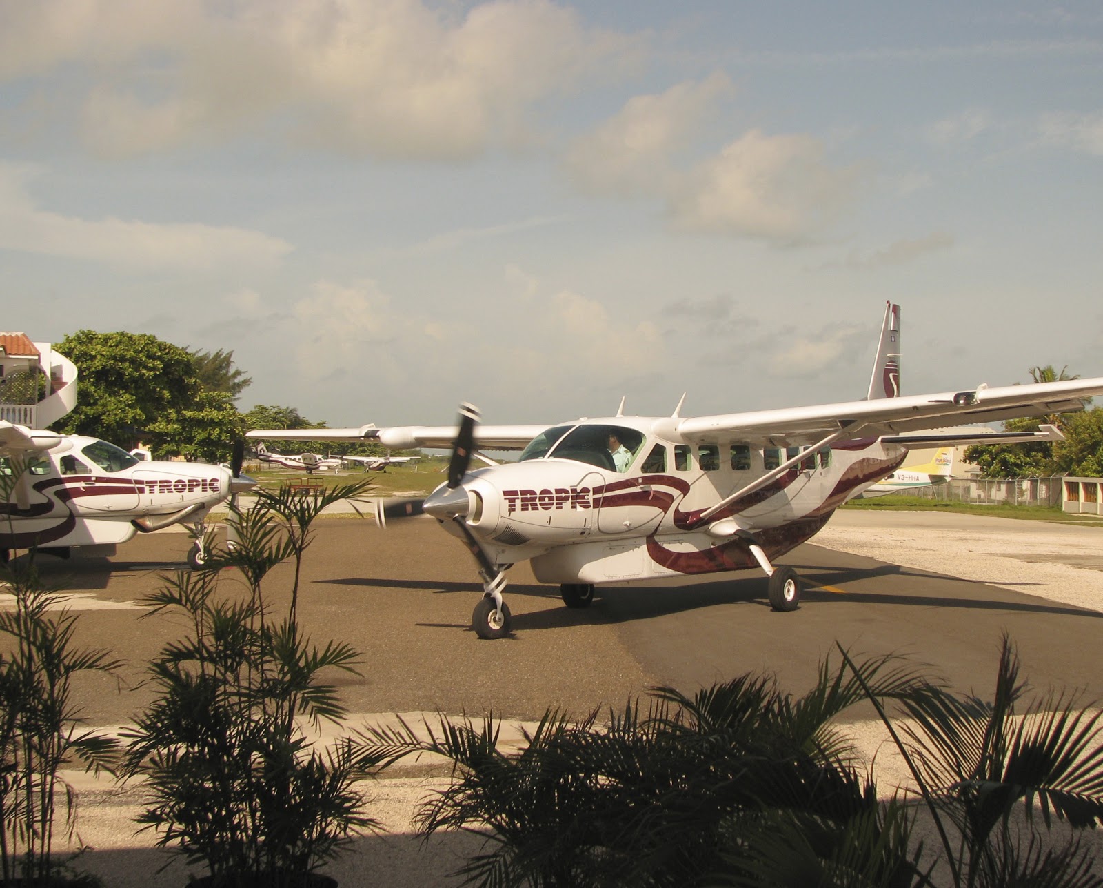
June 12 was all about going home. We caught a Caravan flight over to Belize City at about 8:30 am, then waited at the airport there for a couple of hours until it was time to board our flight to Houston. There were more souvenir shops in the airport, so we didn't mind the long wait.
The runway at San Pedro:

Michelle got right seat this time:


On short final to the airport in Belize City:


We managed to get through passport control and customs in Houston in record time. The last time we almost missed our connecting flight going through there, so this time, we'd planned for a long layover. We went to the ticket counter and asked if we could be switched to the earlier flight, and they let us on. So we got home to Wichita a few hours earlier than expected. Naturally, one of our bags didn't make it home at the same time, but it followed along the next day and the trip ended well.